
Tackling the iconic Tre Cime di Laveredo hike
When I was researching my trip to the Dolomites, there was one hike that seemed to be on everyone’s bucket list – Tre Cime di Laveredo. With a 9-5 desk job, I’m not exactly at the peak of physical fitness, and my “hikes” tend to be limited to daily dog walks. So, how did I fare when I decided to take on one of the Dolomites’ most celebrated hikes – and was it all it was cracked up to be?
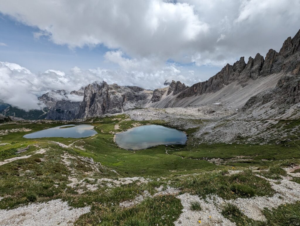
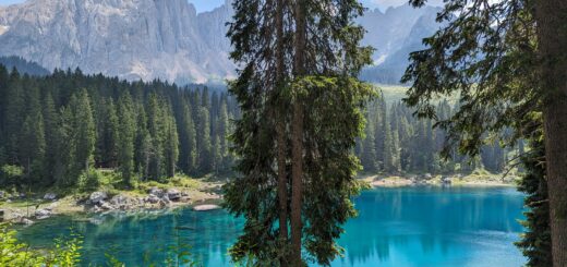
The short answer is “yes” – Tre Cime di Laveredo has views for days, and they’re the kind of views that frequently make you stop in your tracks and exclaim “holy shit!” While the trail largely lacks the greenery of Val Gardena where I stayed for the first part of my trip, the rugged, sprawling landscapes are like nothing I’ve ever seen before, and I made sure to take the 10.8km circular route that led to Lahgi dei Piani (Piani Lakes) – two beautiful lakes that sit side-by-side in a gorgeous valley of wildflowers. If there was ever an incentive to make it through the hike, it was this view, which turned out to be even more spectacular in person:
![]()
So here’s a no-holds-barred account of my day at Tre Cime – and the literal ups and downs that went with it.
Getting to the Tre Cime di Laveredo trailhead by public transport
I’d recommend basing yourself in a town called Dobbacio (known as Toblach in German) because you can catch a shuttle bus (no. 444) that takes you straight to the start of the Tre Cime trailhead. Here’s the current timetable. You can get on at Dobbacio bus station or train station, depending on which is closer to your hotel.
You’ll need to get off at the last stop – Rifugio Auronzo (also referred to as Drei Zinnen and Auronzohutte), but you don’t need to monitor the stops along the way because everyone will be piling off the bus with you.
Warning: You can’t use your Südtirol Guest Pass / Mobil Card on bus 444. With so many tourists taking advantage of the shuttle service, it’s a money-making machine, and I was more than happy to pay 18 euros for the two-hour round trip, given that my transport had been completely free up until that point!
You also need to pre-book your tickets using this website. If I remember rightly, you have to give a definitive time for your journey out, but not for your journey back, so you’re free to stay as long as you like.
You’ll be sent an e-ticket with a QR code to show to the bus driver/attendant. The bus leaves every half an hour, but I’d recommend getting the first bus out, because the trail is incredibly popular and gets increasingly crowded as the day goes on, and there are hundreds of people with hire cars driving up there too.
The bus dropped us off in a large car park directly underneath Rifugio Auronzo, which in itself had amazing views. Everyone ran straight off the bus to go and see them. From the car park, you’ll be able to see Rifugio Auronzo up on the hill above you. I headed to the right to reach it, and it was just a short and steep uphill climb to get to the start of the Tre Cime di Laveredo trailhead, which is situated just behind the building.
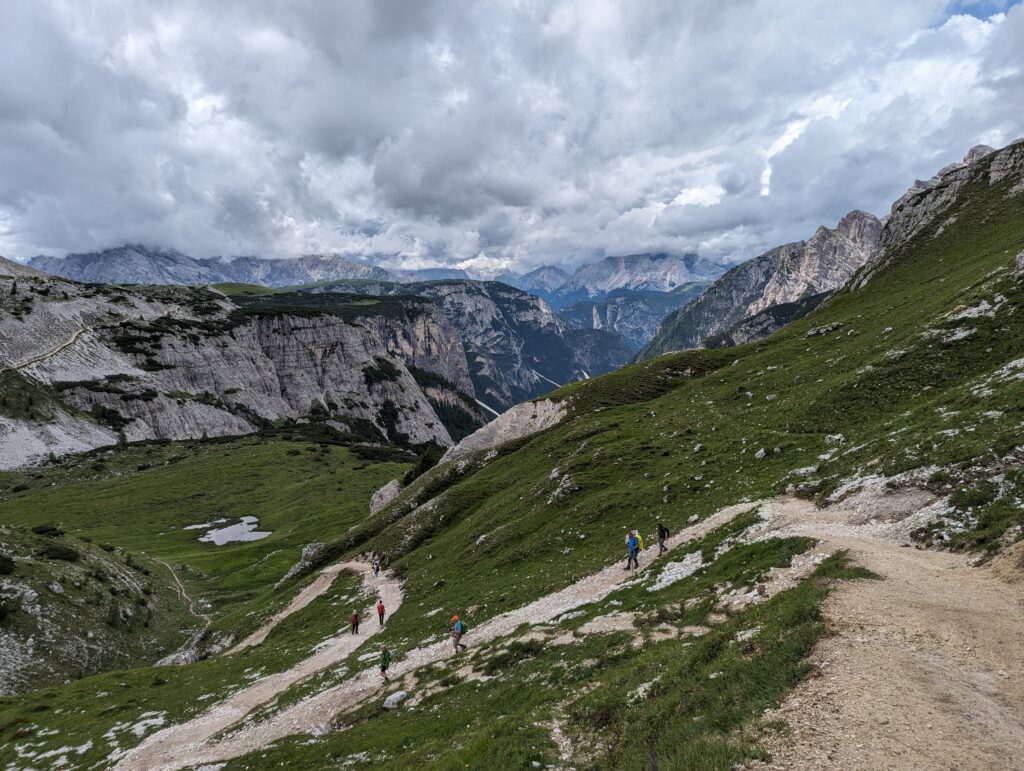
What to expect on the Tre Cime di Laveredo hike
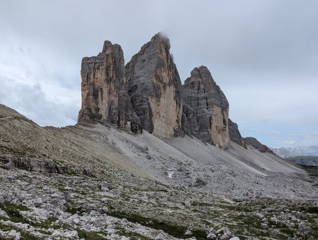
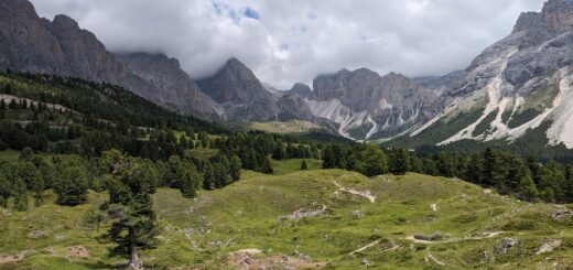
Most people recommend doing the Tre Cime hike anti-clockwise, so I followed their advice and took the trail to the right. The hike from Rifugio Auronzo to Rifugio Laveredo was pretty easy, even by my standards, and there was a lovely little chapel en route too. The terrain was relatively flat and the gravel was quite compact, making it easier to walk on. The views were outstanding the whole way, with a towering mountain massif to your left, the valley and Lake Misurina to your right, and more jagged mountain peaks behind you:
![]()
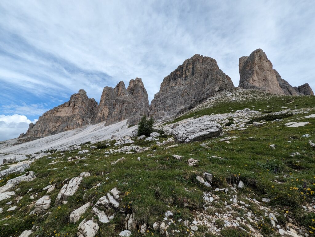
![]()

I’d barely broken a sweat when I arrived at Rifugio Laveredo, but I did need to use the bathroom, and I was slightly dismayed to discover how basic the facilities were. After paying a euro to get through the turnstile, I wasn’t expecting to be greeted by a hole in the ground, so unless you’ve perfected your squatting technique on a damp and disgusting floor, I wouldn’t recommend paying the entrance fee to use the facilities here. I was a bit worried about their food hygiene standards after seeing the state of the bathroom, so I opted not to eat there, either.
On the plus side, Rifugio Laveredo had amazing views and there was an expanse of grass with boulders that were an ideal height to sit on and admire the scenery – a perfect spot for some snacks.
![]()
After that, the terrain started to change pretty quickly and I suddenly found myself on a steep uphill ascent to Forcello Lavareda, from which point you can continue onto Rifugio Locatelli.
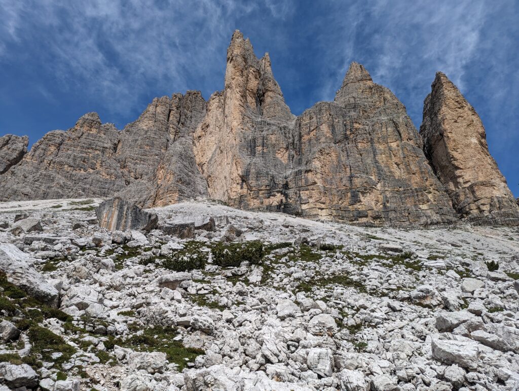
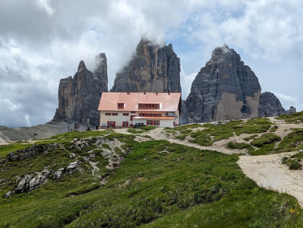
After feeling like I’d gone a few rounds with a Stairmaster, getting to the top of the hill was a revelation. You could see Rifugio Locatelli in the distance – a scene straight out of a postcard – but Tre Cime di Laveredo was suddenly up close and personal in all of its towering glory, too. As I followed the trail to Rifugio Locatelli, there was an outcropping where you could take some pictures standing directly underneath Tre Crime.
![]()
![]()
To say I was blown away would be an understatement – but it was about to get even better!
After more uphills and downhills trying desperately hard not to skid on loose gravel (I can see why everyone – young and old – had walking poles with them), Rifugio Locatelli was only a stone’s throw away. Before you get there, you can choose to head back to your starting point – Rifugio Auronzo – instead of making the trek uphill to the mountain hut… but, unfortunately, if you want to see the views of Laghi dei Piani, you have to go all the way up. I christened the track to Rifugio Locatelli as ‘The Stairway to Hell,’ as it was one massive step up after another, on an unforgiving incline. Mercifully, it didn’t take long to get there, but I’m not going to lie, I was huffing and puffing and had to make a few strategic stops to “admire the view” along the way.
Still, once I arrived, the views of Laghi dei Piani soon made me forget my burning calves. In my opinion, you also get the best views of Tre Cime di Laveredo from here, too, as you’re viewing the peaks head-on, rather than from the side. If that wasn’t enough, there’s also another gorgeous mountain chapel behind the hut, and I managed to capture a great shot of it as the clouds were starting to roll in.
![]()
Heading back to Rifugio Auronzo
I was feeling pretty proud of myself after achieving everything I’d set out to do, especially considering I still had some energy left in the tank (and that was after doing the Cadini di Misurina hike earlier in the morning, too!) Unfortunately, that energy rapidly depleted as I began the journey back to Rifugio Auronzo. As you can see from the pictures above, the clouds were starting to roll in, and it wasn’t long until I heard the distant rumble of thunder. To make matters worse, my phone’s battery was down to 15% because I’d already taken hundreds of photos and videos. I was worried my battery was going to run out before I made it back to the bus and that the driver wouldn’t let me on board without my mobile ticket, so I reluctantly had to turn my phone off, which meant I didn’t capture many pictures on the final stretch of the hike. Still, it was a good life lesson – invest in a battery pack and print out your tickets, folks!
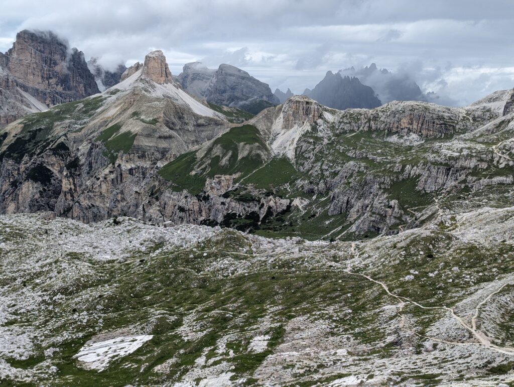
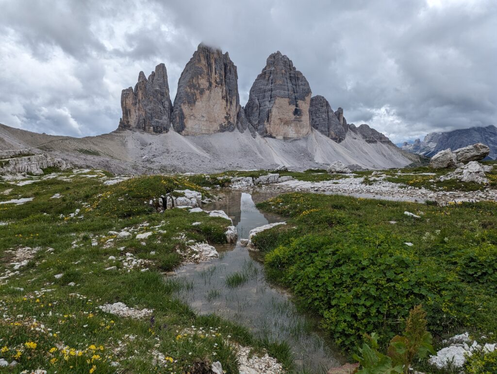
I didn’t feel too bitter about it because the visibility over the valley was getting progressively worse as the storm approached, and it wasn’t long before the three peaks were partially obscured. Still, that’s not to say the views were any less stunning. These were the last couple of pictures I took before my picture-perfect day took a turn for the worse:
I had two choices – to either head back the same way I’d come or to continue the loop and visit the final hut on the All Trails hike I linked to above – Malga Langalm. I decided to head towards Malga Langalm, but I soon lived to regret it. What started out as a lovely hike down into the valley soon lost its novelty, because then you had to hike back up…and up…and up. I definitely wasn’t the only one stopping at regular intervals to try and muster the will to carry on, but I felt obliged to keep going because some of the sections were quite narrow and I didn’t want to hold up the people behind me.
Then, to add insult to injury, the heavens opened in a truly spectacular fashion and, even though I’d come prepared with a fleece and coat, it took all of a minute before I was soaked to the skin – and I couldn’t tell you whether it was with sweat or rain at that point. To say this part of the Tre Cime di Laveredo hike was a hard slog would be an understatement, but when the rain started pouring over the loose gravel in rivulets and I found myself walking through streams that had sprung up out of nowhere, it actually started to feel a bit dangerous too, especially as some parts of this section are very close to the edge of the cliff and the terrain is consistently uneven.
The hike back to Rifugio Auronzo seemed to last forever, even though I’d picked up the pace after seeing some distant streaks of lightning, and I’m sorry to say I barely glanced at Malga Langalm when I finally got there – I was too focused on watching my footing.
Still, I made it back to the car park dripping wet, but unscathed, and the bus was thankfully there waiting for me. I’d love to go back and do the last section of the hike again in better weather – maybe after a few months in the gym – because I feel like I didn’t appreciate it as much as I should have.
That being said, I’ll always be grateful that the weather and visibility were perfect for the first half of the hike and, irrespective of how it ended, it was 1000% worth it.
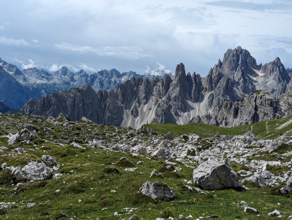
I’d recommend the Tre Cime di Laveredo hike to anyone, and the same goes for the Cadini di Misurina hike I did earlier that morning, which also starts from Rifugio Auronzo.


What a great read. Very informative and good sound advice.
Thanks, Julie! I’m glad you enjoyed it.