The breathtaking beauty of the Seceda to Col Raiser hike
After 10 amazing days in the Dolomites, it was hard for me to rank my favourite hikes because all of them were bucket-list worthy, but if you forced me to choose, my personal highlight would be the Seceda to Col Raiser hike. Most travel enthusiasts will have seen a picture of the towering Seceda ridgeline at some point – a row of jagged mountains slanting sideways, often framed by ominous clouds, but seeing it in person is a memory that will stay with me forever.
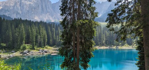
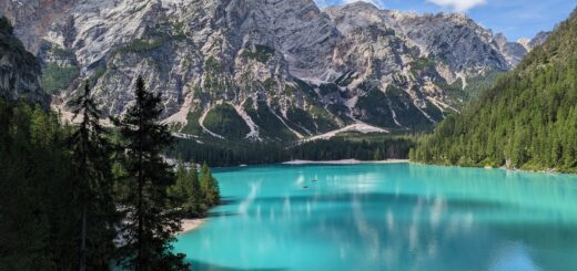
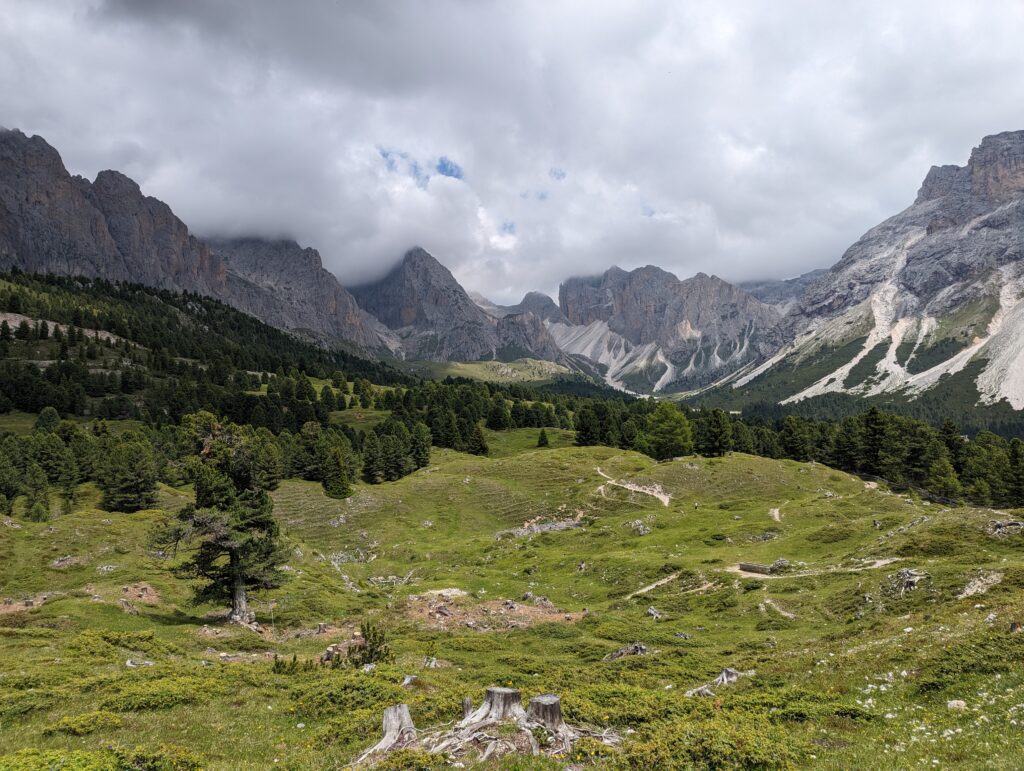
The Seceda ridgeline may be the (literal) pinnacle of this hike, but the views of the surrounding valley and other mountain ranges are every bit as captivating. If you embark on the mostly downhill hike to Col Raiser (taking the trail that leads towards Malga Pieralongia and Rifugio Firenze), you’ll see wild horses and donkeys, a vista of lakes and mountain pastures, and some other-worldly landscapes. Unlike the Tre Cime di Laveredo hike, there is nothing barren about these landscapes – it’s all gorgeous greenery and wildflowers. Even some of the mountains are covered in grass!
Getting to the Seceda ridgeline
I based myself in a bustling town called Ortisei in the Val Gardena region, which is where the cable car to Seceda is located. The cable car station is just a short 5-10 minute walk from Ortisei town centre, which is full of colourful, olde-worlde buildings. As well as being a beautiful destination in its own right, Ortisei is a gateway to some of the best hikes in the Dolomites, including Seceda and Alpe di Siusi. On Google Maps, search for Funivie Seceda Spa and make your way to the cable car station, where you can purchase your tickets and pick up a map. I paid just shy of 40 euros for the ascent and descent (expensive, but well worth it for the views).
At 9am in mid-July, I expected to see queues forming, but within five minutes, I’d bought my ticket and was on my way up. The cable cars run continuously so it’s a case of scanning your ticket and then jumping straight on.
You’ll need to hop off at the middle station – called Furnes – and then take another cable car up to Seceda itself, but the transfer takes no time at all.
How close is the Seceda cable car station to the Seceda ridgeline?
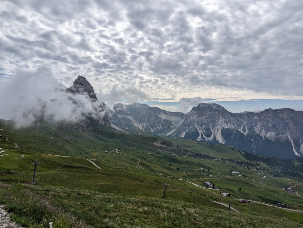
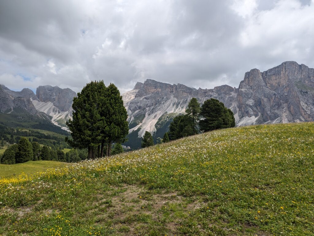
When you disembark from the cable car, prepare to be greeted by awe-inspiring views from the get-go. It was cloudy at first, but thankfully, it didn’t take long to brighten up. You can see the Seceda ridgeline peeping through the clouds to the left of the photo below, which gives you some idea of how close it is to the cable car station.
As soon as you walk out of the station, there’s a row of benches with a 360-panoramic view. I walked over just as a flock of birds were flying by and definitely had one of those “is this real, or am I dreaming?” moments. To be honest, if you wanted a lazy day, you could probably get away with roaming around this area for half an hour and still come away with photos that are the envy of all your friends.
I’m glad I ventured further afield, though.
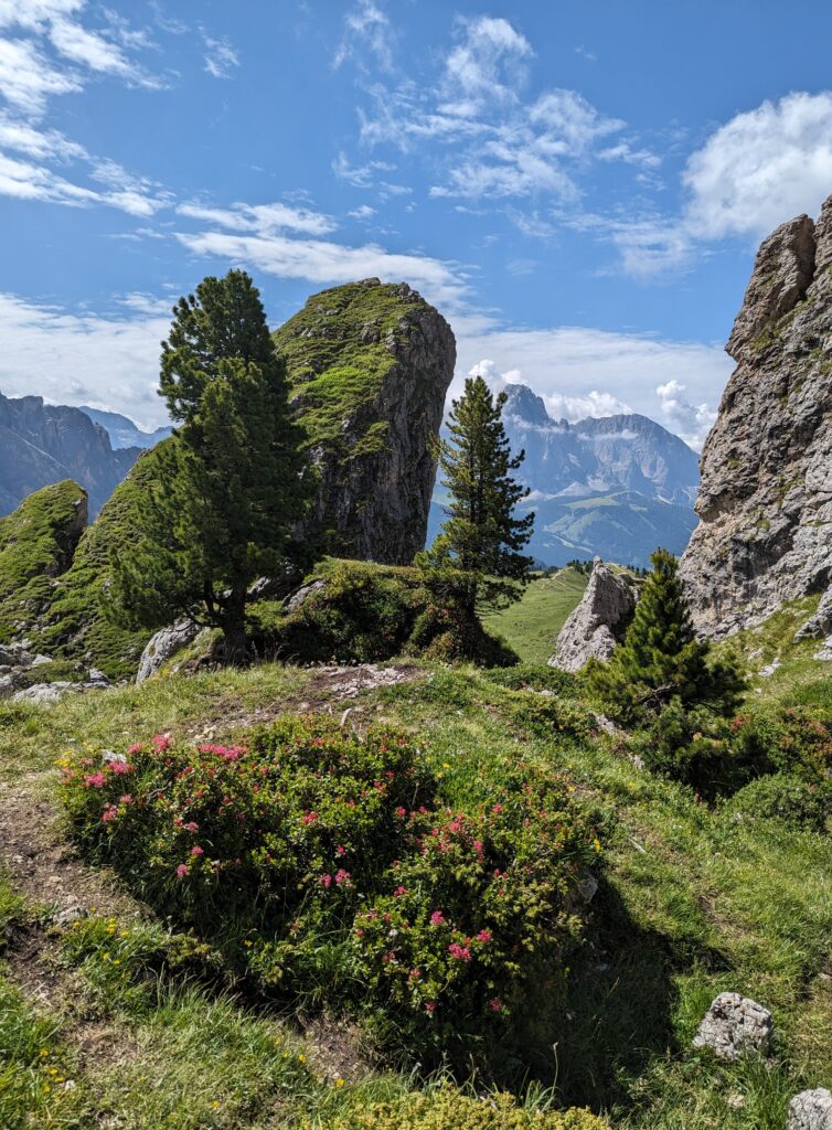
When you get to the Seceda cable car station, you have two choices. You can head down the relatively flat path that runs towards the base of the Seceda ridgeline, so the mountains are towering above you, or you can head up a very steep path that puts you nearer to the top of the ridgeline, presumably with even better views. I took one look at the uphill path and immediately thought “not today,” but I was more than happy with the photos I got from the flat path:
![]()
![]()
![]()
That being said, I was left wondering if I missed out on some even better shots, so if you have the stamina, I’d probably go with the uphill path.
The drop-off into the abyss once you reach the base of the ridgeline is quite a thing to behold, but that didn’t deter a teenage boy who was walking ahead of me from running up the side of the ridge like a mountain goat and posing for a picture at the very top of the outcropping. I nearly had a heart attack watching him, but that must have been one hell of a photo!
Highlights of the Seceda to Col Raiser hike
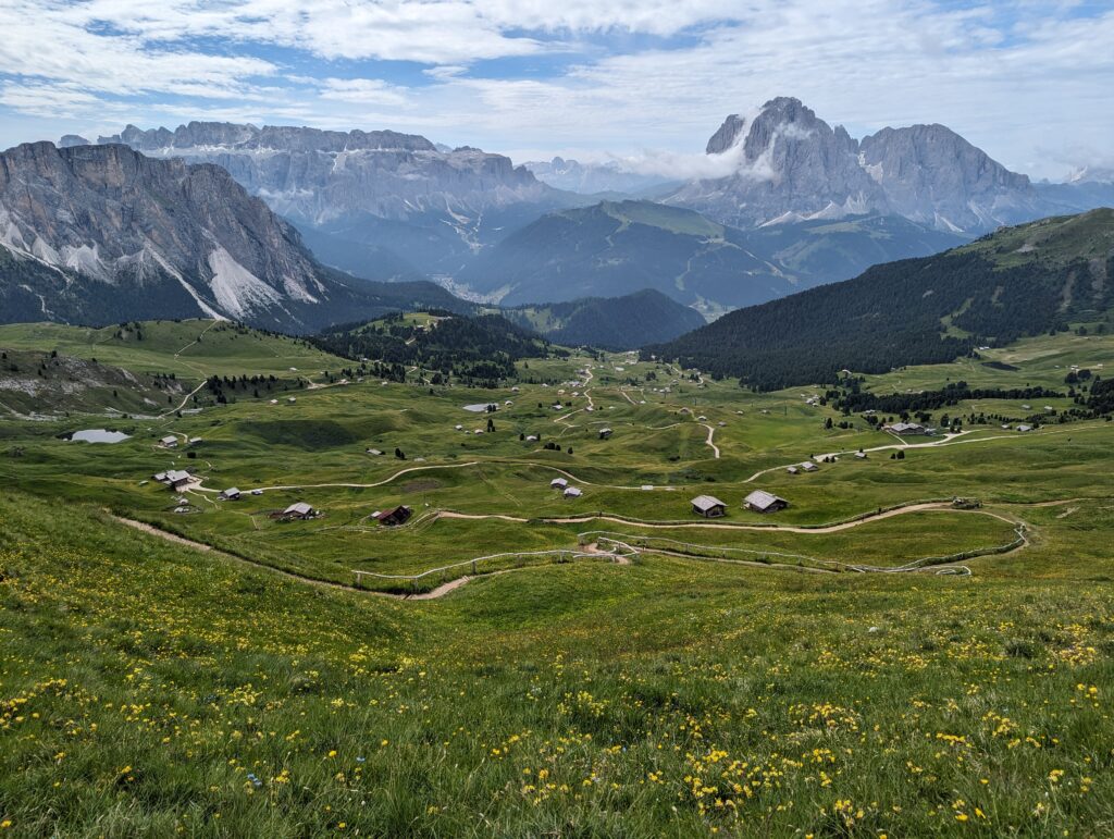
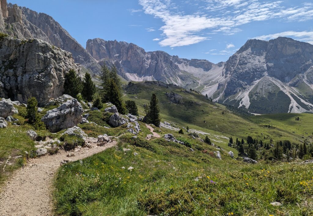
The hike got even better from there. I headed down the path that runs to the right of the Seceda ridgeline – you can literally see the gravel track meandering through the valley, so there’s no risk of getting lost. It’s an easy route, but because you’re heading downhill for the first half of the hike, it’s hard on your knees – or maybe I’m just getting old. There are lots of opportunities to stop for a rest and a bite to eat at a mountain hut along the way, with Baita Troier, Malga Pieralongia Alm, Rifugio Firenze, and Malga Odles all benefitting from stunning scenery.
As I was walking the route between Malga Pieralongia (where everyone stopped to take some photos of the farmyard animals) and Rifugio Firenze, I had to bypass quite a few donkeys who were just casually strolling down the path alongside me.
![]()
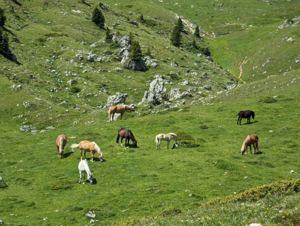
Seeing wild horses grazing in mountain pastures was an unforgettable highlight too:
I also loved the scenery surrounding Malga Pieralongia, where the rocky landscape is offset by beautiful flowers, and features two massive rocks shaped like right-angled triangles positioned in almost perfect symmetry with each other:
![]()
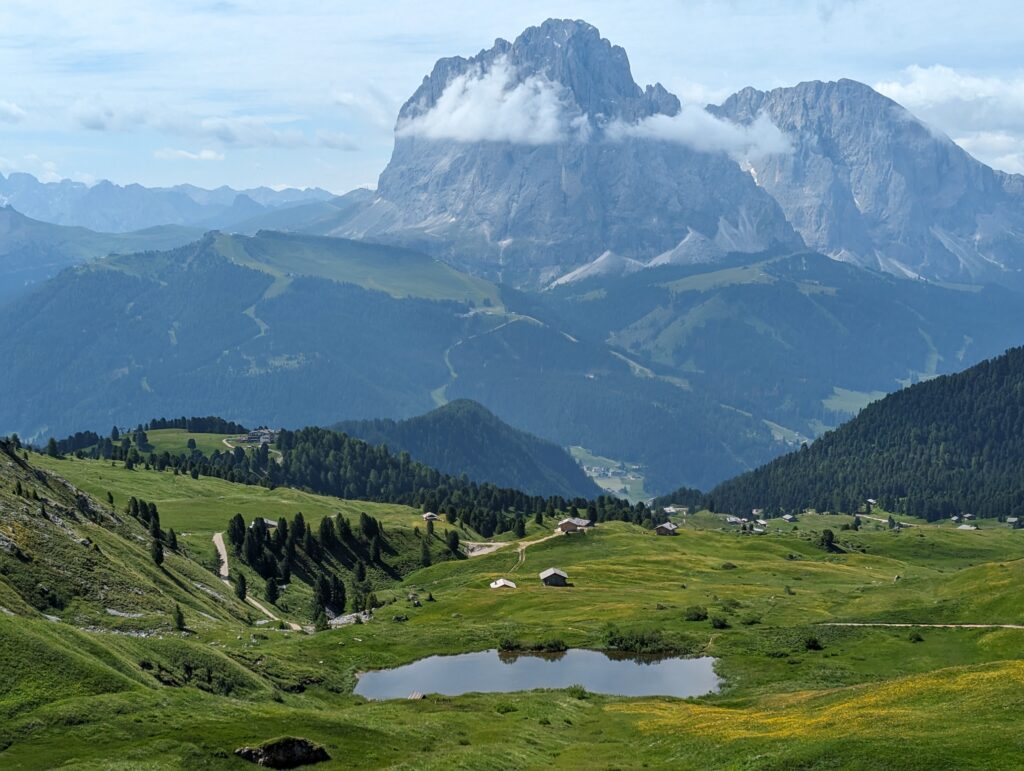
The view just before you get to the Col Raiser cable car station is mind-blowing too, and perked me up when all that walking was starting to take its toll:
Top tip when hiking from Seceda to Col Raiser
By the time I got to Almhotel Col Raiser after a moderately challenging 7km hike, I was too knackered to contemplate hiking back uphill to Seceda again, and wished I hadn’t paid for a round trip on the cable car. The Col Raiser cable car proved to be too tempting, so I reluctantly paid another 18 euros to travel down to the town of Santa Cristina instead, which is (thankfully) only a short bus ride away from Ortisei. There was a bus stop at the cable car station, but the buses didn’t go directly to Ortisei from there, and they weren’t very regular. After checking Google Maps, I decided to walk from Col Raiser to Santa Cristina Dosses, which is where you need to board the bus if you’re travelling back to Ortisei. I was pleasantly surprised to find it only took 15 minutes, and from what I remember, it was all downhill. You’ll need to catch bus 350 or 352 in the direction of Ortisei. The Südtirol Mobil app/website has all the info you need re. timetables.
The views from the Col Raiser cable car were stunning and, because the cable cars run continuously, I managed to get one all to myself, so I promptly video-called my family back home so they could enjoy the experience with me.
It’s worth noting, you can also do this hike in reverse, where you take the Col Raiser cable car up the mountain and then hike to Seceda, but I imagine that route – while every bit as scenic – would be more physically challenging as it would involve a lot of uphill walking.