Why hiking to the Cadini di Misurina viewpoint was the most dangerous thing I’ve ever done
Cadini di Misurina is one of the most celebrated viewpoints in the Dolomites, and rightfully so. With jagged grey peaks jutting towards the sky, it’s a view that some people have compared to Mordor in the Lord of the Rings. The hike there and back is only a two-mile round trip and you can cover it in an hour if you’re fast on your feet. After seeing some truly epic drone footage on Tiktok, I immediately added it to my Dolomites itinerary, and I opted to do it on the same day as the Tre Cime di Laveredo hike, as they both start from the same point – Rifugio Auronzo.
Is it better to hike to Cadini di Misurina or Tre Cime di Laveredo first?
I decided to hike to the Cadini di Misurina viewpoint first. I knew Tre Cime di Laveredo was going to be a long and comparatively gruelling hike, and I was worried I wouldn’t have enough energy left to tackle Cadini di Misurina afterwards.
So, on a mid-July morning at around 9am, I set off from the Cadini di Misurina trailhead at Rifugio Auronzo. If you cross the road and step down to your right after arriving at the hut, you’ll see a signpost for trail #117, heading in the direction of Rifugio Col De Varda (there’s no mention of Cadini di Misurina, but don’t let that deter you). Several other people seemed to have the same idea as me and, while the Cadini di Misurina hike is often described as being far less crowded than Tre Cime, I found there were still plenty of people on the trail. The cat’s clearly out of the bag when it comes to this “hidden” gem.
As with most trails in the Dolomites, there are some steep ascents and descents on loose gravel and walking poles would have definitely come in handy at some points, but the first part of the hike wasn’t too taxing and the views were amazing before I even set eyes on my final destination.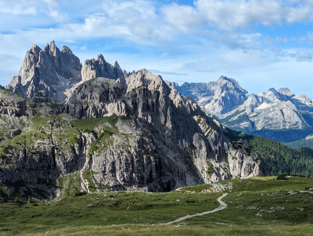
![]()
Which trail should I take to the Cadini di Misurina viewpoint?
When I reached the section of the hike where the trail splits and you can either opt to go left, right, or somewhere down the middle, I followed the advice of the blogs I’d read and headed left with the intention of looping around to the right on the way back – that way you get panoramic views from every angle and you’re not going back the same way you came.
WARNING: IF YOU VALUE YOUR LIFE, PLEASE DON’T DO WHAT I DID.
I knew the left trail ran along the cliff edge and I have a good head for heights, so even though I could see the valley looming below me, I wasn’t deterred by the (huge!) drop at first, because I had a good 1.5 metres of trail to work with and I wasn’t perilously close to the edge.
Unfortunately, that didn’t last for long. I don’t know if I turned off to the left too early (although with the mountain to the right of me, there wasn’t really anywhere else to go), but the trail became so narrow at some points, it was barely wide enough for one foot. The first time I encountered a section that made me question my decision to take the left trail, I only had to take a couple of tentative steps over the narrow area and the path immediately widened again, so I took a deep breath and carried on. I really wish I hadn’t, though, because it got a lot worse.
Don’t get me wrong, the views were great, but I couldn’t take any pictures because I was too busy clinging to the rocks on the side of the mountain and praying they didn’t come loose. I desperately wanted to turn around, but I didn’t dare because a) there was no room to manoeuvre and I wasn’t convinced I could actually pivot my foot and turn around without falling, b) it would have meant re-negotiating the sections I’d already made it through and c) I could see I was much closer to the endpoint than the starting point.
So I sucked it up and soldiered on, with Lady Gaga’s ‘Edge of Glory’ playing on a loop in my head as I focused on putting one foot in front of the other.
I lived to tell the tale – thank God – and it gave me a whole new appreciation for life, but my legs were shaking so much by the time I got back to safe ground, I had to sit on the floor for a while to collect myself. While I was following a route recommended by other bloggers (unless I somehow took a wrong turn!), they obviously didn’t realise how much the trail had eroded since they were last there. Still, I only have myself to blame for persevering when I should have turned around from the get-go. Needless to say, I won’t ever be that stupid again, and I’d encourage everyone to go for the middle trail or the right trail and avoid the left side of the mountain at all costs.
The Cadini di Misurina viewpoint
The viewpoint itself is on an outcropping of rock and you’ll need to watch your step as you’re climbing up there because it’s got a lot of gnarled tree roots on the top and, if you’re as clumsy as I am, there’s a chance you might trip and fall. I wasn’t feeling particularly adventurous after a brush with my own mortality earlier, so I didn’t go all the way to the edge (of glory), but this awe-inspiring view was still worth it:
Unfortunately, I didn’t get to stay in a prime position for long enough to stage a few once-in-a-lifetime selfies, as there was a queue of people forming and impatiently waiting for their turn to stand at the end of the viewpoint, and I felt obliged to get out of the way as quickly as possible. I suspect you’d need to come here very early in the morning or late in the evening if you wanted the area to yourself.
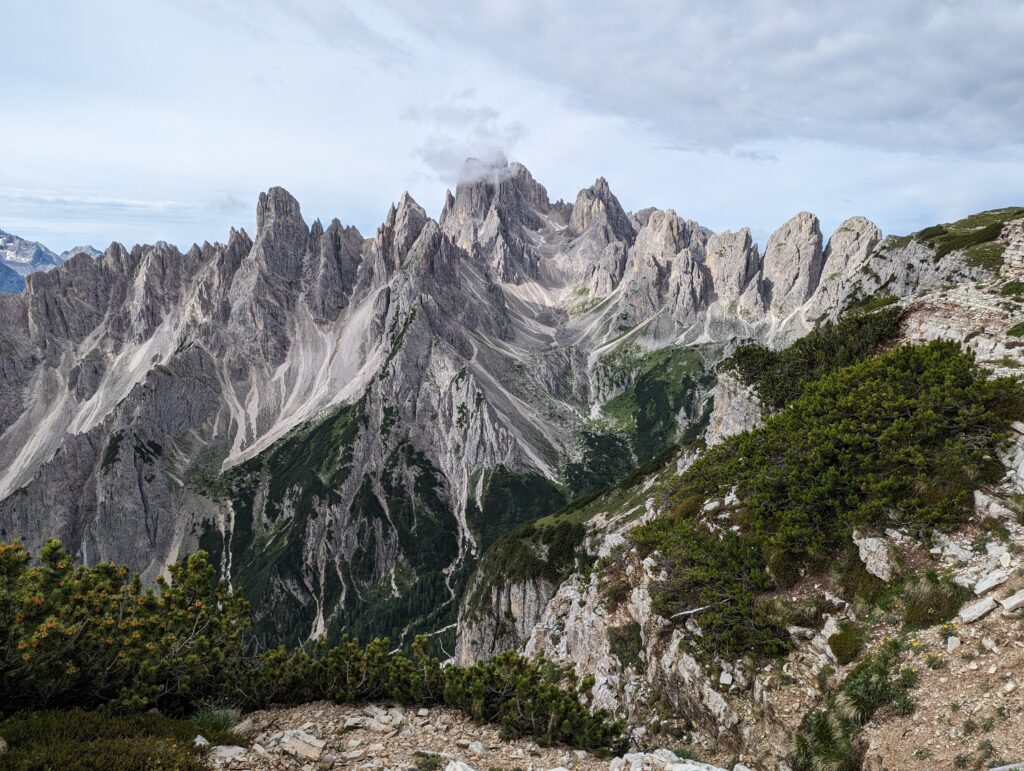
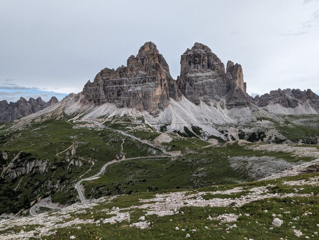
You get an amazing view of Tre Cime di Laveredo as you’re heading back to Rifugio Auronzo, along with some other stunning mountain scenery:
There’s no doubt that Cadini di Misurina is one of the best – and one of the shortest – hikes you can do in the Dolomites, but it was genuinely treacherous at times, so make sure you stay away from trails that lead you too close to the mountain edge.